“King tide” sounds dramatic because it usually shows up in photos: water licking at a seawall, a harbor ramp underwater, a beach that looks smaller than usual. The useful idea is simpler. A king tide is an especially high predicted tide, usually part of a larger-than-normal tide range.
That range matters. Ocean people care about the difference between the high and the low because it changes ramps, channels, beaches, tide pools, mud flats, rocks, docks, and the current moving through all of it. A king tide is a good day to pay attention. It is not a reason to panic, and it is not permission to ignore the rest of the forecast.
Start with the range
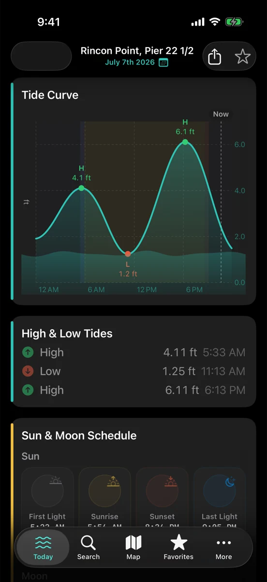
If the predicted high is well above the usual water line and the predicted low drops out later, you are looking at a big tide range. That can make familiar places feel unfamiliar. A boat ramp may be easier at one hour and awkward at another. A beach walk may have room at low tide and none near the peak. A fishing spot may see more moving water through a cut or around structure.
The mistake is treating the high number alone as the whole story. Look at the full curve. How high is the peak? How long does it stay high? How steep is the rise or fall? A fast-moving tide can matter more for your timing than the exact minute printed next to the high.
King tides are predictions, not guarantees
NOAA tide predictions are built around astronomical tide at a station. They are incredibly useful, but the real ocean is still an ocean. Wind can pile water toward shore or pull it away. Low pressure can raise water levels. Long-period swell can run farther up a beach or push through a harbor entrance. Rain and runoff can change local water inlets. Local geography decides how all of that reaches your feet.
So the right sentence is not “the king tide will flood this spot.” The right sentence is “the predicted tide is high enough that I should read around it.” Pair the tide curve with the National Weather Service marine forecast, nearby buoy observations, local alerts, and what you can see on site.
For surfers: watch the shape, not the label
Some breaks like more water. Some get fat, backwashy, or soft. Some only need a little extra tide before the inside rocks disappear. A king tide label does not tell you which one you have. Read the predicted height against the break you know, then check swell direction, period, local wind, and whether the tide is rising or draining during your window.
If the setup looks marginal, slow down. There will always be another tide, and Rip has never once improved a session by yelling at the moon.
For anglers: moving water still beats myth
Big tide ranges can create stronger movement around structure, channels, sand edges, and harbor mouths. That can be useful. It can also make the water messy, push weed around, or make access more complicated. The king-tide part is only one clue.
For surf fishing, look at how the water moves over the beach shape you actually have. Pair the tide with swell, wind, and water temperature if you can. If the access depends on rocks, bars, or narrow cuts staying exposed, plan the exit before the cast.
For boaters: ramps, docks, and current deserve the boring check
Boaters notice king tides in practical places: ramp angle, dock lines, bridge clearance, channel depth, debris lines, and current through constrictions. A higher tide can solve one problem and create another. A big outgoing tide after a high peak can move a lot of water through a harbor entrance or inlet.
Use the predicted tide as a planning aid, then read the official marine forecast and local harbor information. RipCat can put tide, buoy, and advisory context in one place, but it is not a chart, a local notice, or a captain. No app replaces judgment on the water.
How RipCat helps
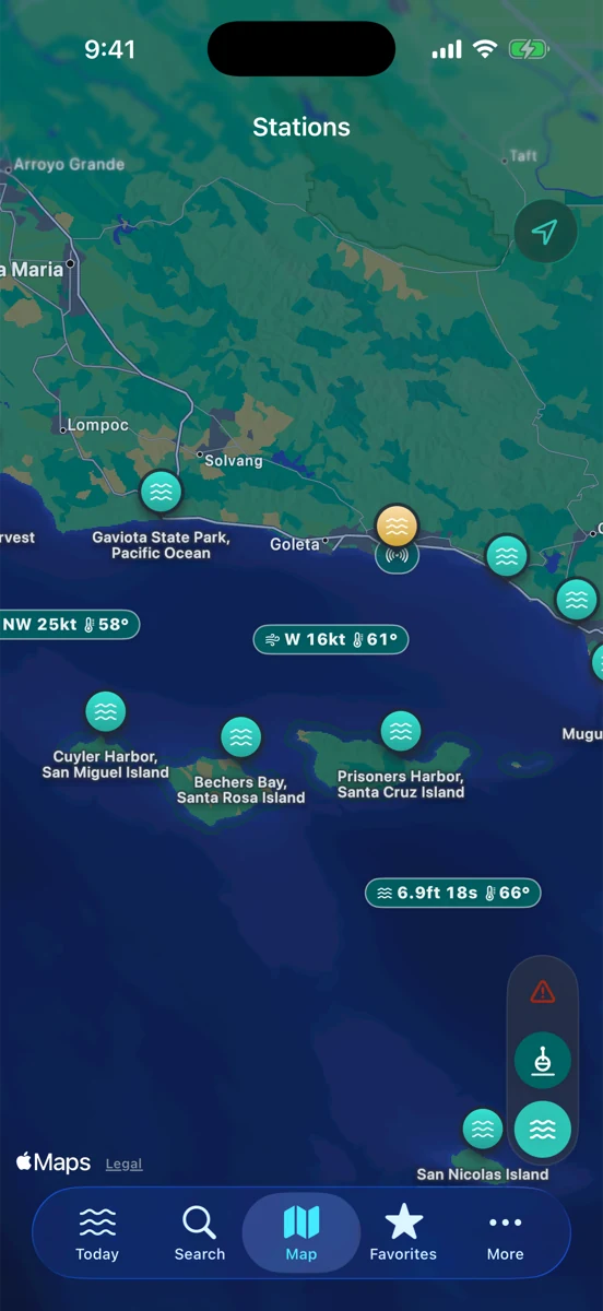
RipCat gives you NOAA tide predictions, NWS marine advisories, buoy observations, and favorite spots in one Apple-native app for U.S. coastal waters. Use it to compare the day’s curve with the broader marine picture before you drive, paddle, launch, or walk down to the sand.
If you are planning by use case, start with the surf view, the fishing view, or the boating view. Station-specific tide pages are still in pilot review, so this post links to the segment guides for now.
Read the range before the water surprises you.
RipCat gives you the tide curve, nearby marine context, and a calm place to plan. U.S. coverage only. Predictions and forecasts are planning aids, not navigation advice.
Get RipCat free on the App Store