Marine forecasts are written in zones because the ocean does not fit neatly into city names. The National Weather Service divides coastal waters into forecast areas with codes like PZZ650 for part of the Santa Barbara Channel. Each zone covers water that can share a broad weather pattern: wind direction, sea height, swell, fog, and advisory timing.
That makes zones useful. It also makes them easy to over-read. A zone forecast is regional, not a promise that every harbor entrance, kelp line, beach break, or lee shore inside it will behave the same way at the same hour.

What a marine zone actually gives you
A marine zone forecast is the broader setup: expected wind, combined seas, swell direction and period when available, visibility, and any advisories or warnings for that area. It answers a first question: what does the weather office think is happening across this stretch of water?
That is different from a tide station, which gives predicted astronomical water level at a specific station. It is different from a buoy, which reports observations at one sensor location. The zone forecast is the bigger weather story. The tide and buoy are local clues you use to check that story against the place you are actually going.
Why nearby water can feel different
Inside one zone, islands, points, headlands, kelp, shoals, harbor shapes, and afternoon heating all matter. In Santa Barbara, a west-end Channel read can feel different from an east-end read. A beach tucked behind a point can be quiet while exposed water outside the corner is getting pushed around. A harbor mouth can stack up when wind and tide oppose each other, even when the open-water forecast looks moderate.
That does not make the zone forecast wrong. It means the forecast is doing its job at the regional scale, and your job is to translate it into the small piece of coast in front of you.
Read the timing, not just the headline
Most useful marine forecast details are timing details. When does the wind build? When does the advisory start? Are seas expected to ease overnight or hold through the morning? Does the swell period change with the wind, or is a longer-period swell running underneath local chop?
A single phrase like “Small Craft Advisory” or “seas 3 to 5 feet” can hide a full day of change. The difference between a clean early window and an ugly ride home is often the timing line, not the headline.
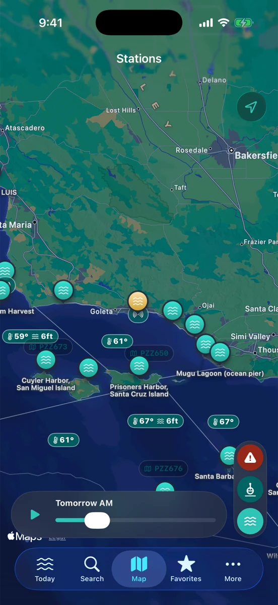
Put the zone next to a buoy
The buoy is your reality check. If the marine forecast says northwest wind should build this afternoon, look at nearby wind trend and gusts. If the forecast mentions steep short-period seas, compare wave height and period. If the zone says conditions are easing but the buoy is still climbing, slow down and keep reading.
For surfers, the buoy helps separate swell direction and period from local wind texture. For anglers, it adds water temperature, wind, and trend before the drive. For boaters and sailors, it helps turn a broad advisory into a more practical pre-departure question: what is the water doing now, and is it lining up with the forecast?
Then add the tide
Tide predictions do not tell you the weather. They tell you the astronomical water level baseline at a station. But tide stage can change how a forecast feels in a specific place. Wind against tide can steepen chop. A shallow entrance can care more about tide height than open water does. A beach can lose useful sand or structure at the wrong water level.
Read the zone for the weather, the buoy for the current observations, and the tide curve for local timing. If all three point the same direction, you have a cleaner picture. If they disagree, the disagreement is the useful part.
How RipCat helps without pretending to decide for you
RipCat brings NWS marine zones, NOAA tide predictions, and NOAA/NDBC and compatible CDIP buoy observations into one Apple-native app for U.S. waters. The point is not to turn the screen green or red. The point is to keep the official forecast, the observation trend, and the tide curve close enough together that you can make a calmer, more informed plan.
If you want to read this by use case, start with the boating and sailing view, the fishing view, or the surf view. Station-specific tide pages are still in pilot review, so this guide links to the best available segment pages for now.
Read the zone, then read the water.
RipCat puts marine zones, tide predictions, buoy observations, and advisory timing in one clean app. U.S. coverage only. Forecasts, observations, and predictions are planning aids, not navigation advice.
Get RipCat free on the App Store