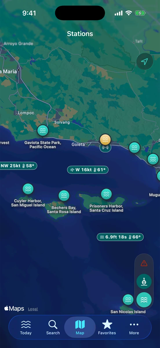
The nearest tide station is a good place to start. It is not always the best place to stop. A station can be around the corner from your spot and still miss the way a sandbar drains, how a harbor entrance squeezes current, or how a point breaks at one stage of the tide and shuts down at another.
That does not make the prediction useless. It means the prediction needs a little context. NOAA tide stations give you an astronomical baseline for a specific location. Your job is to read how that baseline usually translates to the beach, ramp, jetty, slough, or channel you actually care about.
Distance matters, but shape matters more
A tide station five miles away on the same open coast can be more useful than a station two miles away inside a protected harbor. The harbor station may be excellent for a slip, launch ramp, or inner-channel check. It may be less helpful for a surf break outside the point. The open-coast station may line up better with the outside beach, even if the map distance is longer.
Look at what sits between the station and your spot: headlands, islands, river mouths, dredged channels, long beaches, shallow flats, marshes, and harbor walls. Those features can change timing, current, access, and how much water is actually over the piece of bottom you care about.
Station type tells you what question it answers
Some stations are great harbor references. Some are open-coast references. Some sit far enough inside a bay that the water movement at the mouth feels different. Before treating the curve as your spot’s exact truth, ask what question the station is naturally answering.
For a boater, the right question might be “how much tide is at the ramp and what is the entrance doing?” For a surf angler, it might be “is there enough moving water across this bar to make the walk worth it?” For a surfer, it might be “is this reef on the part of the tide where it usually has room to work?” Those are related questions, not identical ones.
Read the phase, not just the height
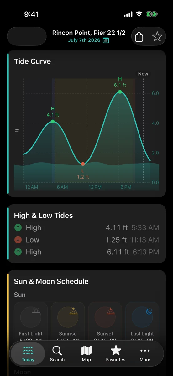
The number on the tide card is useful, but the phase of the tide is often more useful. Is the water rising, falling, near slack, or on the steep part of the curve? A spot that fishes best on moving water may care more about the slope than the exact height. A beach walk or tide-pool visit may care about how long the low window lasts before the flood starts filling back in.
RipCat shows the tide as a curve because the curve gives you that timing. High and low tide labels are landmarks. The slope between them is where the plan usually happens.
Nearby observations keep you honest
Tide predictions do not include every local nudge. Wind, pressure, swell, runoff, and harbor operations can move real water around. A buoy cannot tell you the tide height at your feet, but it can tell you whether wind, waves, and swell are making the coast act differently than the quiet prediction on the tide card.
That is why a useful pre-check pairs the tide station with marine context. Read the NOAA tide prediction for timing. Read the National Weather Service forecast for wind, seas, and advisory windows. Read nearby buoy or station observations for what the ocean has been doing recently. Then look at the water when you arrive.
Build your own local translation
After a few sessions, you start building a mental offset. Maybe your favorite beach needs more water than the nearest station suggests. Maybe the harbor mouth gets more interesting on a strong ebb with afternoon wind. Maybe a low tide that looks great on paper leaves the reef too dry unless there is enough swell.
Write those little translations down, even if only in your head: “this place likes a rising mid tide,” “that bar needs water moving out,” “this launch is easy near slack,” “that path disappears fast once the flood starts.” The station gives you the repeatable baseline. Local memory turns it into something practical.
A simple way to choose a station
First, start with the nearest NOAA station in the same water body or coastal exposure. Second, ask whether a harbor, point, island, river mouth, or long inside bay sits between the station and your spot. Third, compare the station’s curve against what you actually see over a few visits. Fourth, keep a backup station in mind when the nearest one is clearly answering a different question.
If you are planning by use case, start with the surf view, the fishing view, or the boating view. Station-specific tide pages are still in pilot review, so this post links to the segment guides for now.
Use the station. Read around it.
RipCat brings NOAA tide predictions, NWS marine advisories, and buoy observations into one calm app for U.S. coastal waters. Use it as a planning aid, not navigation advice.
Get RipCat free on the App Store