Water temperature looks like a simple number. Sixty-two degrees. Fifty-seven. Seventy-one. For surfers, anglers, boaters, divers, and beach-day planners, that number can change the feel of the whole plan.
But buoy temperature is not a promise about every inch of water between the station and the beach. It is a sensor reading at a place, at a time, in a moving ocean. Read it that way and it becomes useful. Treat it like a guarantee and it will humble you.
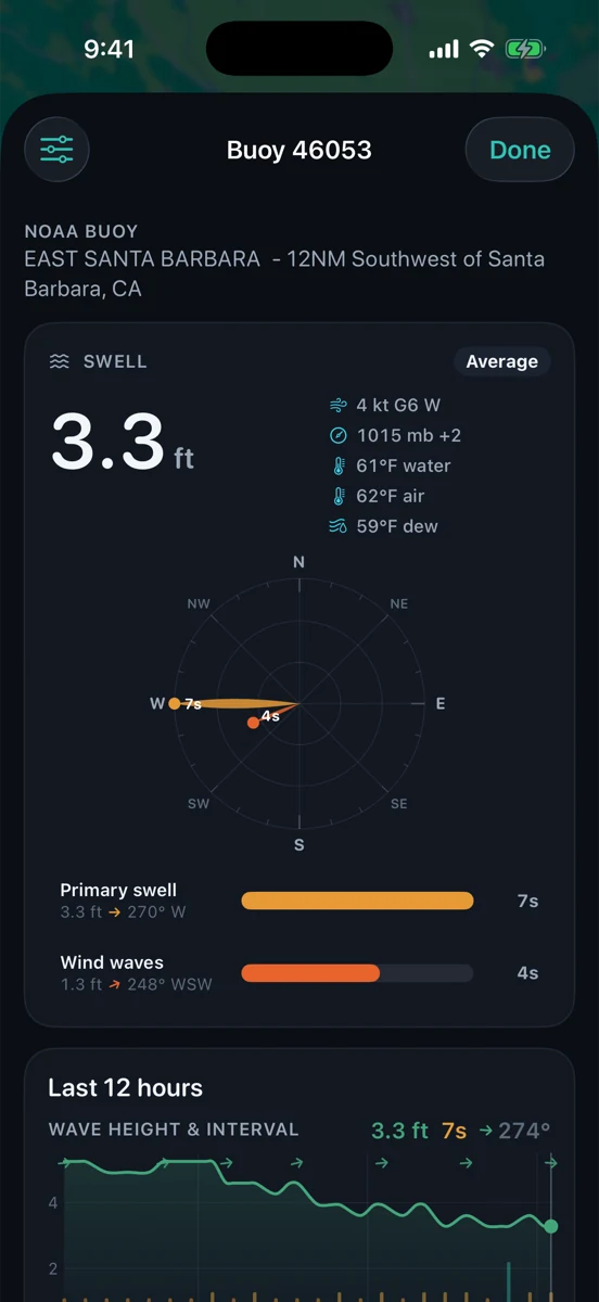
First: where is the sensor?
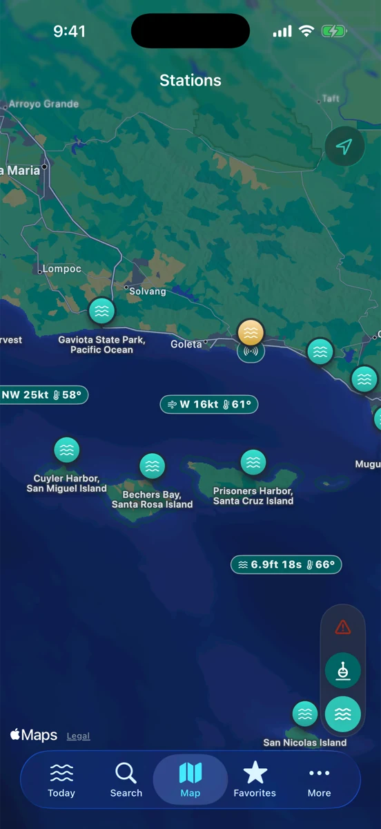
A buoy does not report “Santa Barbara water temperature” in a blanket sense. It reports the temperature measured by that station. Some stations sit offshore. Some sit in channels, harbors, or exposed water. A beach tucked behind a point, a kelp line, a river mouth, or a shallow sand flat may feel different from the buoy.
Before you make the number too important, look at the map. Ask whether the buoy is in the same water mass you care about, whether islands or headlands sit between you and the station, and whether local wind or current could be moving different water into your spot.
Trend matters more than a single reading
A temperature snapshot is useful. A temperature trend is better. If the buoy has been slowly warming for two days, that tells a different story than one warm reading after a sunny afternoon. If the number drops fast after a wind shift, the change may matter more than the exact degree.
For anglers, a steady temperature edge can help explain where bait or activity might shift, without pretending the buoy knows where the fish are. For surfers and swimmers, a quick drop can be the difference between “springsuit maybe” and “wish I brought the full suit.” For boaters, the temperature itself may be less important than what it says about changing air, wind, fog, or upwelling patterns around the day.
Wind can move the number
On the California coast, wind is often part of the temperature story. Persistent wind can push surface water around and help bring colder water up from below. A clean morning after several windy afternoons can still carry yesterday’s water. A calm spell can let surface water warm in protected places.
That does not mean “wind equals cold” every time. It means the temperature belongs next to wind speed, gusts, direction, and the last few hours of history. If the wind and water temperature changed together, slow down and read the pattern before you call it a new normal.
Tide changes what you actually touch
The buoy may be offshore, but your feet, hull, or line are in local water. Tide movement can pull different water across a bar, through a harbor mouth, over a reef, or along a beach. At low tide, shallow sand and tide pools can warm or cool faster than deeper water. On the flood, that local pocket can get replaced.
That is why temperature and tide are better together. Check the tide prediction for the timing, then read the buoy to see the broader water mass. If you are fishing, think about structure and moving water. If you are surfing, think about exposure, tide stage, and wind. If you are boating, add the marine forecast and route.
Do not turn temperature into a catch guarantee
Fish care about water temperature, but they do not read blog posts. Temperature can help you notice patterns: a warm pocket, a cold push, a break between water masses, a change after wind. It cannot promise a bite. Bait, light, bottom shape, swell, pressure, clarity, and plain old luck all get a vote.
Use temperature as one clue in the stack. Pair it with tide movement, wind, swell, and what you already know about the beach, harbor, or kelp line. The best anglers are not looking for one magic number. They are looking for a setup that makes sense.
How RipCat helps
RipCat brings NOAA tide predictions, NDBC and compatible CDIP buoy observations, and National Weather Service marine advisories into one Apple-native app for U.S. waters. When a buoy reports water temperature, RipCat keeps it close to wind, waves, swell, pressure, and history so you can see the whole read instead of one floating number.
If you want the use-case view, start with the fishing page, the surf page, or the boating and sailing page. Station-specific tide pages are still in pilot review, so this post links to the segment guides for now.
Read the temp, then read around it.
RipCat puts tide predictions, buoy history, water temperature when reported, and marine advisories in one clean app. U.S. coverage only. Observations, forecasts, and predictions are planning aids, not navigation advice.
Get RipCat free on the App Store