A harbor entrance can be boring in the morning and unpleasant after lunch without anything mysterious happening. The tide starts moving. The afternoon wind fills in. The channel squeezes current through a narrow piece of water. A little ocean swell shows up at the wrong angle. Suddenly the same route feels steeper, wetter, and a lot less friendly.
That is the heart of wind against tide. Current is trying to move one way. Wind is pushing the surface the other way. The energy piles up instead of stretching out. Waves can stand closer together, get choppy, and stack in the places where current, bottom shape, and harbor walls focus them.
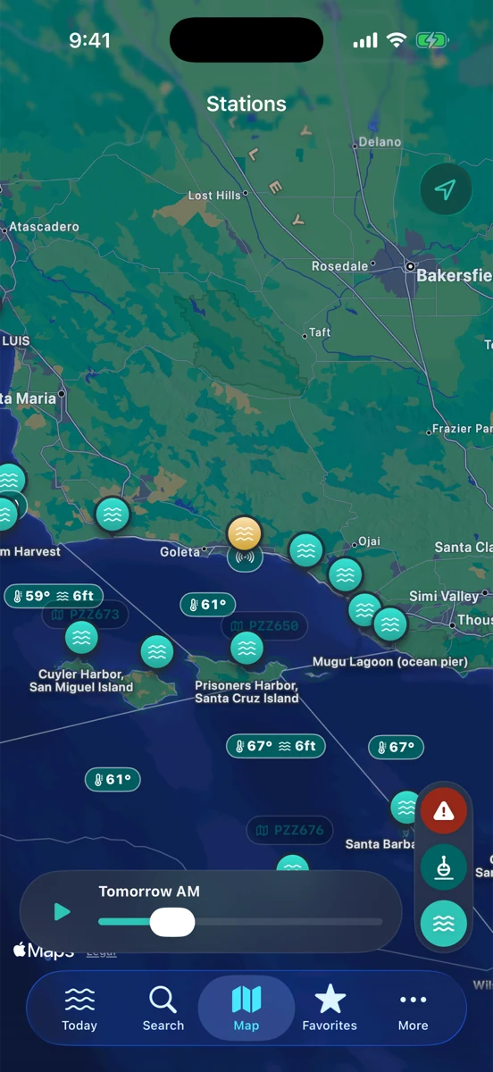
Start with the tide stage
Slack water is the quiet part of the conversation. Around high or low tide, current can slow before it turns. As the tide starts to flood or ebb, moving water builds. The exact strength depends on the place: inlet width, harbor shape, river flow, dredged channels, shoals, kelp edges, and how much tide range is on the board that day.
RipCat shows NOAA tide predictions as a curve because the curve tells you more than a single high or low time. Look at where you are on the slope. A steep part of the curve means water is changing faster. If that moving water lines up against a building breeze, give the entrance more respect.
Then read the wind
Wind with the tide can stretch surface texture out. Wind against the tide can shorten it up. That does not automatically make the day unsafe, and it does not automatically shut down a launch, but it is a strong reason to slow the plan down and read more than the headline forecast.
Use the National Weather Service marine forecast for the broader window: wind direction, expected speed, gusts, seas, and any advisory timing. Then compare that to nearby observations. A buoy or C-MAN station can show whether wind is already arriving early, whether gusts are jumping ahead of the forecast, or whether the sea state has been building for hours.
Buoys tell you what the forecast cannot see perfectly
A buoy is still just one sensor in one place, but it is a useful reality check. Look at wave height, period, direction where reported, and the recent trend. If the forecast says afternoon wind and the buoy history already shows waves getting steeper, treat that as context. If the buoy is far offshore or around a corner, remember that it may not match the exact harbor mouth.
Rip’s rule: read the buoy, then read around it. The best read comes from comparing the tide curve, marine forecast, buoy trend, and the water in front of you. If those pieces disagree, do not average them into a fake green light. Treat the disagreement as the point.
Harbor shape gets a vote
Some entrances handle wind against tide better than others. A wide, deep channel with room to turn around is a different animal from a shallow bar, a rock-lined mouth, or a narrow cut with current boiling through it. Local knowledge matters because the same wind direction can be sheltered in one harbor and fully exposed in another.
For boaters and sailors, that means checking the entrance, not just the bay. For kayaks and paddleboards, it means thinking about the return leg before you leave the dock. For anglers working jetties, beaches, or harbor mouths, it means planning where the water will move after you get comfortable.
For surfers and beach people: the same physics shows up smaller
Wind against tide is not only a boating phrase. Surfers see it when a clean-looking window gets bumpier as the tide turns and wind texture pushes against the moving water. Beach walkers see it when a low-tide path starts disappearing faster than expected on the flood. Surf anglers see it when current, weed, and wind chop make a promising bar harder to fish.
The lesson is the same: do not let the last hour’s conditions do all the talking. Check what the next hour is doing. Is the water rising or draining? Is the wind building or backing off? Is the buoy trend steady or climbing? Conditions change; the useful plan leaves room for that.
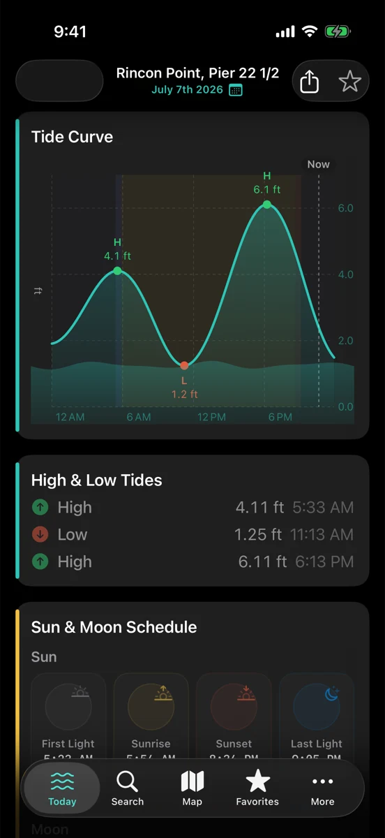
A simple pre-harbor check
Before you commit, make the check boring. First, read the tide curve and note whether the water is near slack, flooding, or ebbing. Second, read the NWS marine forecast for wind direction, gusts, seas, and advisory timing. Third, look at the nearest useful buoy or station trend. Fourth, ask how that wind and current meet the actual harbor entrance, beach, or channel you are using.
If you are planning by use case, start with the boating view, the fishing view, or the surf view. Station-specific tide pages are still in pilot review, so this post links to the segment guides for now.
Read the turn before you leave the dock.
RipCat brings NOAA tide predictions, NWS marine advisories, and buoy observations into one calm app for U.S. coastal waters. Use it as a planning aid, not navigation advice.
Get RipCat free on the App Store