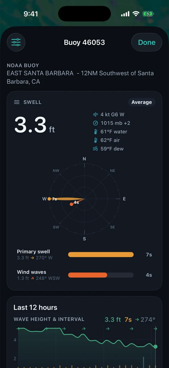
A swell rose looks calm: colored petals, tidy labels, maybe a few arrows pointing toward the water you care about. The ocean is less polite. A rose is a shortcut for reading swell direction and period, not a promise that a beach, harbor mouth, or fishing zone will behave a certain way.
Used well, it helps you answer three useful questions before you burn the morning: Where is the energy coming from? How much period is behind it? Is my spot exposed to that direction, sheltered from it, or somewhere in between?
Direction is the first filter
Swell direction tells you where the energy is coming from. A west swell, a south swell, and a northwest wind sea can all show up in the same week and make completely different places look good or ugly. Islands, points, harbor jetties, shoals, and the curve of the coast decide what actually reaches the water in front of you.
For Santa Barbara, direction is never abstract. The Channel Islands can block, bend, or leave room for different windows. A west-northwest pulse may show one kind of signal. A long-period south swell may sneak into places that looked sleepy on a local wind-chop day. The rose helps you see the source direction before you assume the beach will match the headline height.
Period tells you how organized the energy is
Period is the time between waves or swell lines. Short-period energy usually means local wind sea: closer together, steeper, and more chaotic. Longer-period swell usually traveled farther and carries more organized push. Two reports can both say three feet and feel nothing alike if one is three feet at six seconds and the other is three feet at sixteen seconds.
Surfers tend to feel that difference right away. Anglers and boaters feel it too, just in different language: surge around rocks, lump at the harbor entrance, uncomfortable spacing on the ride home, or a beach that gets harder to read even though the tide looked right.
Height needs exposure
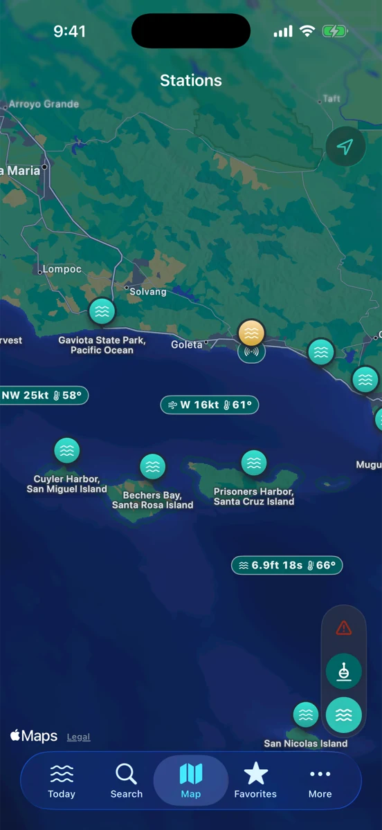
Wave height without exposure is easy to overread. If your coast is pointed at the incoming swell, the number matters more. If your spot sits behind an island, inside a bay, or around a point from the swell direction, the same buoy height may show up weaker, later, or not much at all.
That is why a swell rose belongs next to a map. The rose tells you the direction and character of the energy. The map tells you whether your stretch of coast has a door open to it. When those two disagree, believe the geography enough to slow down and check more sources.
Trend beats one snapshot
A rose is most useful when it moves. Is the dominant direction swinging? Is the period stretching out? Is a short-period wind sea building over the top of cleaner swell? Is the buoy stale? A single snapshot can sell a clean story that the last six hours do not support.
Before you commit, compare the rose with the latest buoy timestamp, the National Weather Service marine forecast, and the tide window you are targeting. If swell is rising into an afternoon wind, the morning plan may not survive the ride home. If period is fading while tide goes slack, that clean-looking window may be narrower than it seemed.
Use-case matters
A surfer may be hunting for the right direction and period for one exposed sandbar or point. A surf angler may care more about manageable whitewater, current, wind, and where bait can hold. A small-boat crew may care most about steepness, gusts, and how the return route lines up with the sea.
Same rose, different questions. The mistake is treating it like a universal green light. A friendly-looking surf signal can still mean a nasty harbor entrance. A small craft day that is clearly a no-go offshore might still leave a protected shoreline walk worth taking. Read the rose through the thing you are actually doing.
How RipCat helps
RipCat brings NOAA tide predictions, NWS marine advisories, and NOAA/NDBC or compatible buoy observations into one Apple-native app for U.S. waters. The point is not to make the call for you. It is to put the tide curve, buoy trend, map context, and marine forecast close enough together that you can make a calmer plan.
If you are building the habit, start with how to read a buoy report, then pair it with why tide predictions are not guarantees and what a Small Craft Advisory actually means. For use-case views, see RipCat for surf, fishing, and boating. Station-specific tide pages are still in pilot review, so this post uses the live segment and guide pages for internal links.
Read the direction before you chase the number.
RipCat puts tide predictions, buoy observations, and marine advisories in one clean app. U.S. coverage only. Observations, forecasts, and predictions are planning aids, not navigation advice.
Get RipCat free on the App Store