Santa Barbara fall surf has a different feeling from summer. The mornings get a little sharper, the parking-lot coffee matters more, and the first northwest energy starts making people text each other too early. It is easy to see a promising number on a forecast and skip the rest of the read.
That is usually where the bad calls start. A fall setup is not just swell height. Around here, the Channel Islands, points, kelp beds, tide stage, local wind, and marine advisories all get a vote. The better pre-check is not complicated. It is just a small stack of questions you answer in the same order every time.
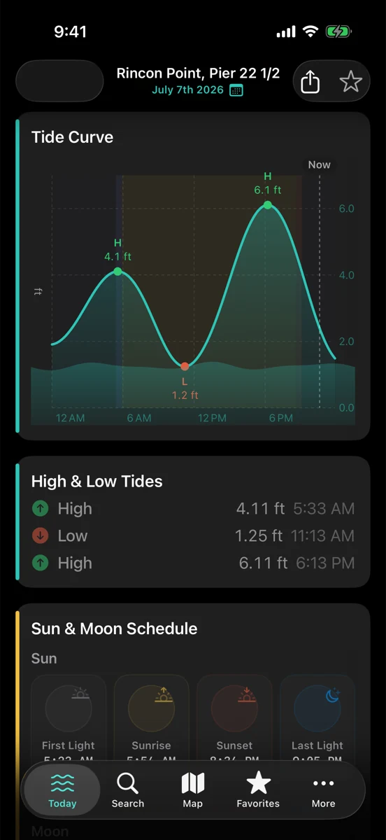
1. Pick the tide window before the spot
The first question is not “Where is it best?” It is “What is the water doing when I can actually surf?” A point, reef, or beachbreak can change quickly across a fall morning. Too much water may soften it. Too little may make it sectiony, shallow, or just not worth the paddle. The tide does not tell you whether it will be good. It tells you which part of the morning deserves the closest look.
For surf fishing, boating, and beach plans, that same habit still helps. Tide stage affects current, exposed structure, harbor depth, beach access, and how much room you have to work with. RipCat shows NOAA tide predictions as predictions, not guarantees, so pair the curve with what you see at the water.
2. Read direction before you chase size
A northwest swell on the Central Coast is not the same thing as a clean Santa Barbara wave. Direction decides what has a clear path, what gets shadowed, and what bends into corners. The Channel Islands can make a headline number feel smaller along one stretch and surprisingly alive somewhere else. A little south leftovers mixed in can also change the shape.
This is where a swell rose or buoy direction read earns its keep. Do not treat the biggest number as the best number. Ask whether the energy is pointed at the coast you are thinking about, whether the period has enough organization, and whether local geography is likely to block, bend, or focus it.
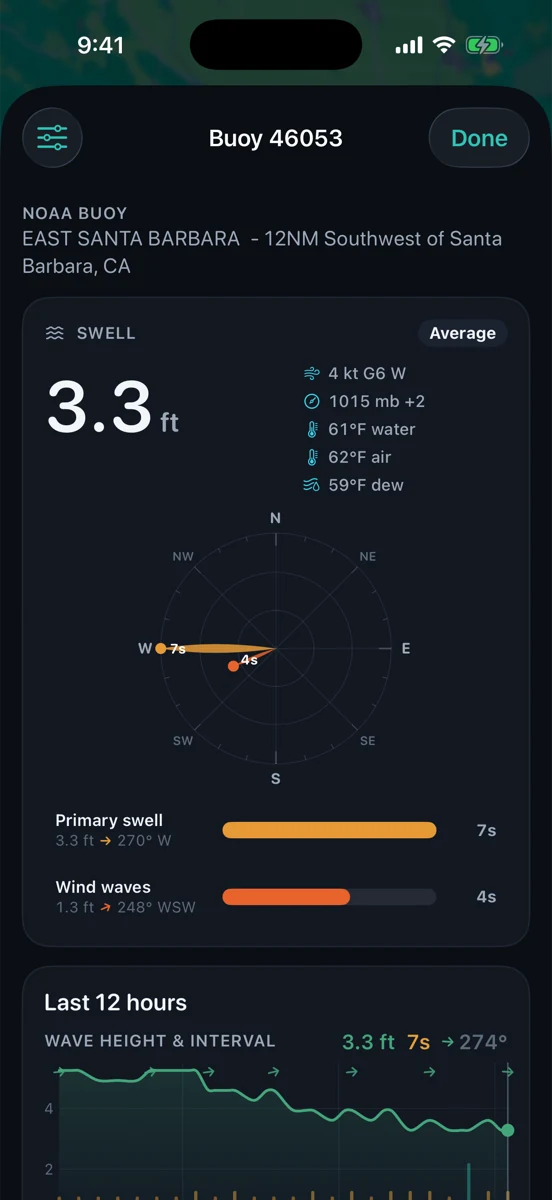
3. Check period and trend, not just height
Two reports can both say three feet and mean different mornings. Three feet at six seconds is often local wind sea or short-period lump. Three feet at sixteen seconds has traveled farther and can show up with more push, especially where the coast is exposed to the direction. Period is not a guarantee either, but it explains why the same height can feel sleepy one day and solid the next.
Trend matters just as much. Is the buoy building, fading, or stale? Is wind sea stacking on top of cleaner swell? Did the period jump overnight, or has it been slowly backing down since midnight? A single snapshot can make you overconfident. A six-hour trend usually tells a truer story.
4. Let wind and advisories veto the fantasy
Fall mornings can start glassy and still turn fast. Local wind, outer-water wind, and an NWS marine forecast are different pieces of the same picture. A Small Craft Advisory is not a surf forecast and not a universal no-go button, but it is a serious heads-up that the water may be rougher, gustier, or less forgiving than the pretty swell number suggests.
If you are surfing, that may mean a shorter window or a different spot. If you are boating, it may mean a dock conversation instead of a channel crossing. If you are fishing a jetty or open beach, it may change where you stand and when you leave. Rip’s rule is simple: let the boring caution notes have a vote before the excited part of your brain wins.
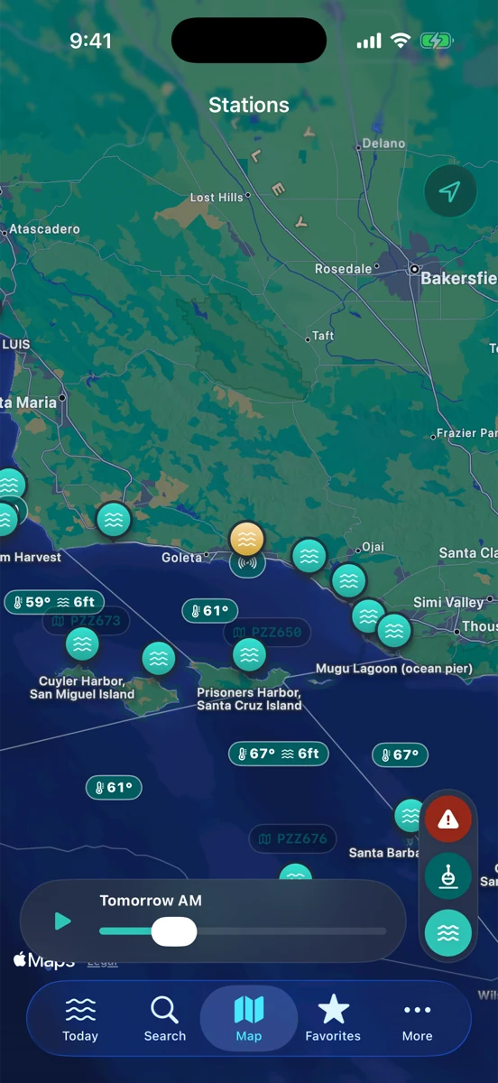
5. Build one repeatable fall check
Here is the habit: tide window first, swell direction second, buoy period and trend third, wind and advisories fourth, then the local check. If those pieces mostly agree, you have a plan. If they disagree, slow down. Maybe you wait an hour. Maybe you choose a more protected stretch. Maybe you bring coffee and watch before you suit up.
RipCat puts NOAA tide predictions, NWS marine advisories, and NOAA/NDBC buoy observations close together so the pre-check takes less digging. It does not replace local knowledge, eyes on the water, or official safety guidance. It just keeps the useful pieces in one clean Apple-native place before you make the call.
If you want to tighten the read, start with how to read a swell rose, then pair it with how to read a buoy report and why tide predictions are not guarantees. For use-case pages, see RipCat for surf, fishing, and boating. Station-specific tide pages are still in pilot review, so this post links to the live guides and segment pages instead.
Make the pre-check boring, then go have fun.
RipCat brings tide predictions, buoy observations, and marine advisories into one clean app for U.S. waters. Planning aid only — not navigation advice.
Get RipCat free on the App Store